
Walk a Yakima County Street
A sound street search moves from the physical place to the records tied to it. The Characteristic Parcel Search supplies parcel, situs, owner, legal-description, neighborhood, and tax-code clues. GIS then places the lot among nearby parcels. A recorded deed can confirm the transfer behind an owner name, while a permit adds dated work on the building.
- Normalize the number, direction, street name, and suffix.
- Save the Assessor parcel number and exact situs form.
- Inspect the same parcel and nearby taxlots in county GIS.
- Check city or county permits by address and parcel.
- Search the Auditor index by owner, date, document type, and legal clue.
Keep a capture date. Parcel, permit, and voter information can change, and each source answers a different question.
Read Yakima Street Parcel Cards
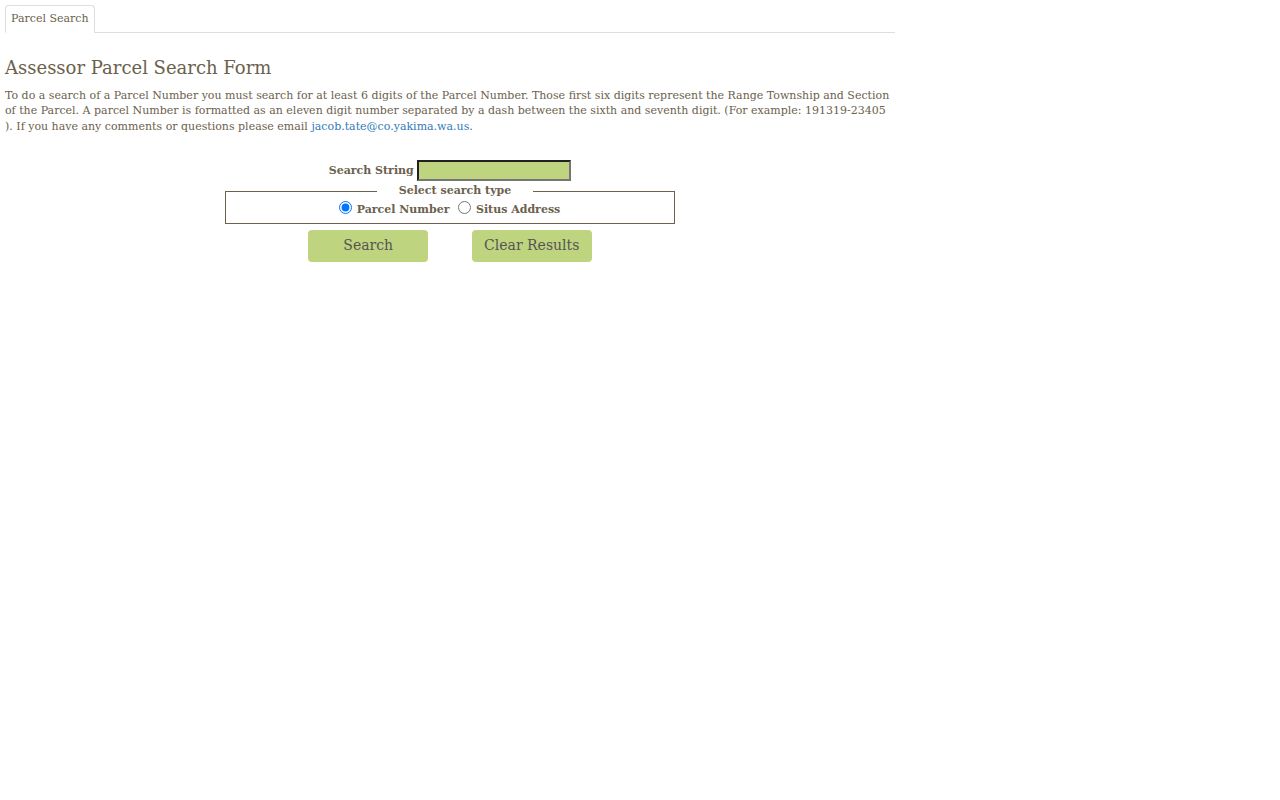
The Assessor card is the strongest first stop for a modern address. Its identity group may show parcel number, situs address, use, acreage, neighborhood, owner, tax-code area, and abbreviated legal description. Other groups describe buildings, utilities, land, detached structures, crops, irrigation, excise transactions, mergers, and seven years of value categories. These fields make a street directory more exact than a name list.
| Card field | Street-search use | Limit |
|---|---|---|
| Situs Address | Tax location | Not an owner mailing address |
| Parcel Number | Joins maps, permits, and transactions | May change after a split |
| Owners | Current index name | Does not prove occupancy |
| Legal Description | Checks land continuity | May be abbreviated |
| Excise Transactions | Points to a transfer | Not the deed image |
The Assessor's Office treats these as valuation tools. The Treasurer confirms current tax amounts, while the recorded instrument supports title research.
Open the official parcel search before relying on its screen.
Search Yakima Addresses Precisely
Small address differences matter. County permit instructions allow number ranges, direction, street, type, city, state, ZIP, and parcel number. They recommend a percent wildcard around the street stem. For example, %alder% can catch directional and suffix variants. For one site, use the first number box instead of filling every field and filtering out the match.
| Field | Method | Save |
|---|---|---|
| Number | One value or a range | Returned number |
| Direction | Try blank and likely prefix | Displayed form |
| Street | Use the documented wildcard | Original spelling |
| Type | Try broad and exact searches | St, Ave, Rd, or other |
| Parcel | Use after an Assessor match | Cross-system link |
City Code Administration answers city permit questions at 509-575-6126. County Public Services answers county questions at 509-574-2300. A public applicant or contractor is a project role, not proof of residence.
Yakima County Street Record Layers
No single roll answers every address question. Keep the source, date, and meaning of each result apart.
| Source | Keeper | Contribution | Access |
|---|---|---|---|
| Parcel card | Assessor | Situs, owner, legal and building context | Web tools and office |
| Parcel map | GIS | Taxlot shape, streets, planning layers | Viewer and Open Data |
| Instruments | Auditor | Deeds, easements, plats, liens | AVA, office, mail, paid tools |
| Permits | City or county | Project, date, status, public roles | Search, phone, request |
| Voter information | Elections | Limited dated registration fields | VoteWA or restricted request |
Washington voter files are restricted to political purposes. They are not a general street mailing list. A registration address is dated, can become inactive, and may be replaced by a protected address.
Map Yakima County Street Parcels
The county GIS page links parcel, planning, precinct, commissioner-district, groundwater, utility, history, and open-data resources. A map can reveal a corner lot, alley, odd taxlot, or several taxable interests at one location. Save the selected parcel, street label, active layer, and date.
GIS staff are at 128 N 2nd Street, Room 100, 509-574-2990, with listed weekday hours of 8:00 a.m. to 4:00 p.m. The map is illustrative, not a legal survey. Recorded plats, surveys, and legal descriptions control legal-boundary work.
- Parcel
- A unit of land used for tax and record indexing.
- Situs address
- The physical tax location, distinct from correspondence addresses.
- Plat
- A recorded map dividing land into lots, blocks, streets, or easements.
- Criss-cross directory
- A dated directory arranged by street and number.
Follow Yakima Street Deeds
The Auditor's research instructions describe AVA as a free index. It reaches to August 1, 1985. Images generally begin February 23, 1997. Documents between those dates may be indexed yet available only on microfilm. That 1985 and 1997 divide is vital to any Yakima County street directory search.
In-office research at 128 N 2nd Street, Room 117 is unlimited during listed weekday hours of 9:00 a.m. to 4:00 p.m. Official Records Online supports orders, Tapestry is an occasional paid tool, and Laredo Anywhere is a subscription. Mail and counter copy requests are also available. Regular copies cost $1 per page; certified copies cost $3 for page one and $1 for each added page. Online orders add a $10 service fee.
View the AVA recorded-document index before using this captured screen.
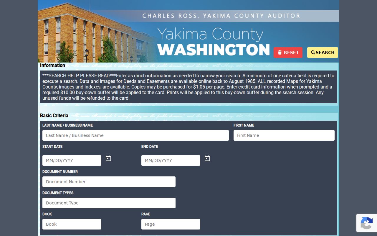
Note: Compare the legal description, parcel clue, type, and date before accepting a same-name deed result.
Build a Yakima Street Timeline
Permits add dates that a parcel card may not explain. Search county records with the documented street variants, then check City of Yakima codes and permits for city sites. Save permit number, type, status, application date, project address, parcel, and public links. If the address fails, try the parcel or former wording.
A permit can help distinguish a vacant lot from a later structure or explain changed building traits. It never supplies a household roster. State an applicant, builder, or contractor role exactly as the record labels it.
Check Yakima Street Postal Labels
A Yakima postal name does not prove a parcel lies inside Yakima city limits. The USPS lookup can standardize a full address and return a recognized city and ZIP. County parcels and GIS answer jurisdiction separately. This matters across broad Yakima routes and rural communities.
Historic searches add North Yakima, Yakima City, and Union Gap. Preserve the old wording, then compare legal description, lot and block, map footprint, and intersections. No verified block-level renumbering date was found, so do not invent one. The Yakima County city directory collection can extend a dated address trail.
Log Yakima Street Results
A worksheet keeps a plausible match from becoming an unsupported claim. Save the exact query, URL, date, situs, parcel, owner display, legal description, permit, instrument, map layer, and any conflict. Record “no result” only after testing direction, suffix, wildcard, city, ZIP, and parcel forms.
- Preserve directional and street-type variants.
- Keep multiple situs strings when parcel numbers match.
- Check merger history when parcel numbers differ.
- Mark index-only deeds apart from accessible images.
- Date every owner or registration field.
This turns a one-time street directory search into work another person can repeat.
Limits of Yakima Street Directories
Property tools identify taxable parcels and displayed owners, not every resident. Permits document work. Maps show geography. Postal results show routing. None supplies a complete live household list. Washington's Address Confidentiality Program may also hide a location by design.
Use street records for family research, property curiosity, deed checks, or civic work. Confirm title through the instrument and boundaries through a survey. Never turn an owner, voter entry, or directory line into a claim about a full household.
Lawful use. Do not use Yakima County address records to stalk, harass, threaten, track, or harm another person.
Read Yakima Plats and Easements
A street name can lead to more than a deed. The Yakima County Auditor records plats, surveys, easements, agreements, liens, and judgments alongside transfers. A plat is the recorded map that lays out lots, blocks, roads, and other features in a subdivision. An easement is a recorded right to use part of the land for a stated purpose. These instruments can explain a shared drive, utility strip, access route, renamed subdivision, or parcel shape seen in GIS. They should not be read as a list of people who live nearby.
Begin with the legal description from the Assessor card. Search AVA by the displayed owner and likely document type, then compare instrument number, recording date, party names, parcel reference, lot, block, and subdivision. If a map or survey image is not online, save the index citation and use the Auditor counter, mail-copy route, or documented order service. Older indexed instruments may be on microfilm. Staff can help locate an image, but they cannot conduct a title examination or decide what a recorded right means.
County GIS Data and Products offers another access path for parcel and aerial products. Downloadable layers can help compare lots along one Yakima County street, while in-person map products help when the web viewer fails. Mapped lines are illustrative, may differ from recorded documents, and are not a legal survey.
Request Yakima Address Records
Some useful street records have no complete public index. The county MyCustHelp portal accepts Public Records Act requests, shows a knowledge base and public archive, and lets a requester track or download responses. City of Yakima administrative, public works, and code material uses the separate RecordsApp. Municipal court records follow court rules instead of the ordinary city request process.
Ask for an identifiable record rather than an answer to who lives at the address. Give the street number, alternate street forms, parcel number, department, record type, approximate dates, and desired format. The agency generally responds within five business days by producing records, linking to them, acknowledging the request with an estimate, or explaining a denial. Exempt and protected information stays closed.